Peer-reviewed papers
Callaghan, K.L., Wickert, A.D., Barnes, R., and Austermann, J.: The Water Table Model (WTM) (v2.0.1): coupled groundwater and dynamic lake modelling. Geoscientific Model Development, 18, 1463-1486, 2025.
Wickert, A.D., Williams, C., Gregoire, L.J., Callaghan, K.L., Ivanović, R.F., Valdes, P.J., Vetter, L. and Jennings, C.E.: Marine‐Calibrated Chronology of Southern Laurentide Ice Sheet Advance and Retreat:∼ 2,000‐Year Cycles Paced by Meltwater–Climate Feedback. Geophysical Research Letters, 50, 2023.
Austermann, J., Wickert, A.D., Pico, T., Kingslake, J., Callaghan, K.L., and Creel, R.C.: Glacial isostatic adjustment shapes proglacial lakes over glacial cycles. Geophysical Research Letters, 49, 2022.
Barnes, R, Callaghan, K.L., and Wickert, A.D.: Computing water flow through complex landscapes – Part 3: Fill-Spill-Merge: Flow routing in depression hierarchies. Earth Surface Dynamics, 9, 105-121, 2021.
Barnes, R, Callaghan, K.L., and Wickert, A.D.: Computing water flow through complex landscapes – Part 2: Finding hierarchies in depressions and morphological segmentations. Earth Surface Dynamics, 8, 431-445, 2020.
Callaghan, K.L., and Wickert, A.D.: Computing water flow through complex landscapes – Part 1: Incorporating depressions in flow routing using FlowFill. Earth Surface Dynamics, 7(3), 737-753, 2019.
Callaghan, K., Engelbrecht, J., and Kemp, J.: The use of Landsat and aerial photography for the assessment of coastal erosion and erosion susceptibility in False Bay, South Africa. South African Journal of Geomatics, 4(2), 65-79, 2015.
Computer code
Callaghan, K. L., Barnes, R., and Wickert, A. D. (2024). Water Table Model (WTM): Source Code. Zenodo.
Barnes, R., and Callaghan, K. L. (2020). Fill-Spill-Merge Source Code. Zenodo.
Barnes, R., and Callaghan, K. L. (2019). Depression Hierarchy Source Code.. Zenodo.

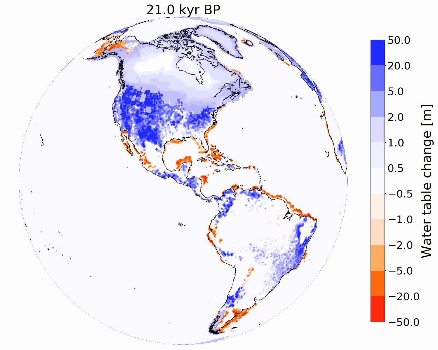
Simulation of the changes in the water table in the Americas over the past 21,000 years