Simulating changing water table
The Earth's hydrologic system includes complex links between many pieces: the ocean, ice sheets and glaciers, atmospheric water, rivers, and of course, lakes and groundwater. Groundwater is a vital resource and is widely used for irrigation and drinking water. Although human impacts on groundwater are extensively studied, changes in groundwater and lake storage over longer time periods is not well understood. One important question is: how does long-term climate change influence global groundwater distribution?
Over the last deglaciation (21,000 years ago to present day), changes in sea level and ice volume under a changing climate are a key area of research.
Sea level rose by ~120-130 m during this time period as massive ice sheets melted and retreated. However, changes in the water table - representative
of groundwater and lake water storage - are not well understood. We are only now beginning to understand even the order of magnitude of changes
in these water stores between the Last Glacial Maximum (LGM) and the present day.
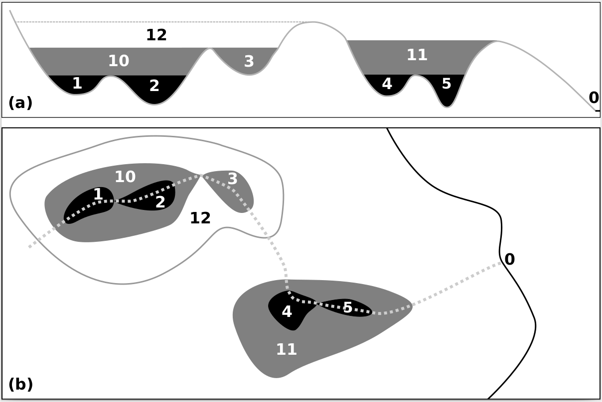
In my research, I use the Water Table Model to simulate changes in global water table over hundreds to thousands of years. Preliminary results indicate
that additional water stored in and on the ground at LGM accounted for sea level change in the order of several decimetres.
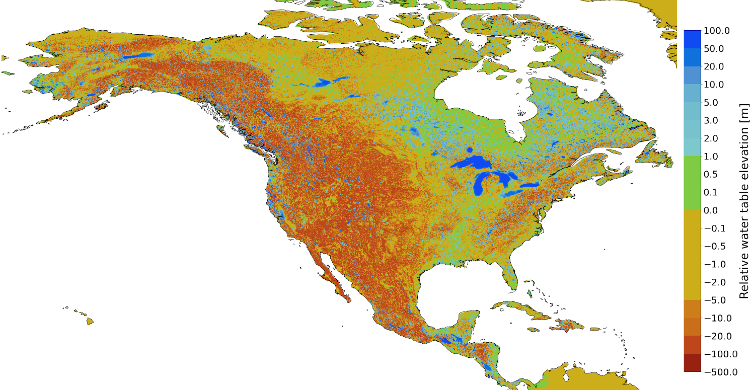
Simulated water table relative to the land surface for the North American continent.
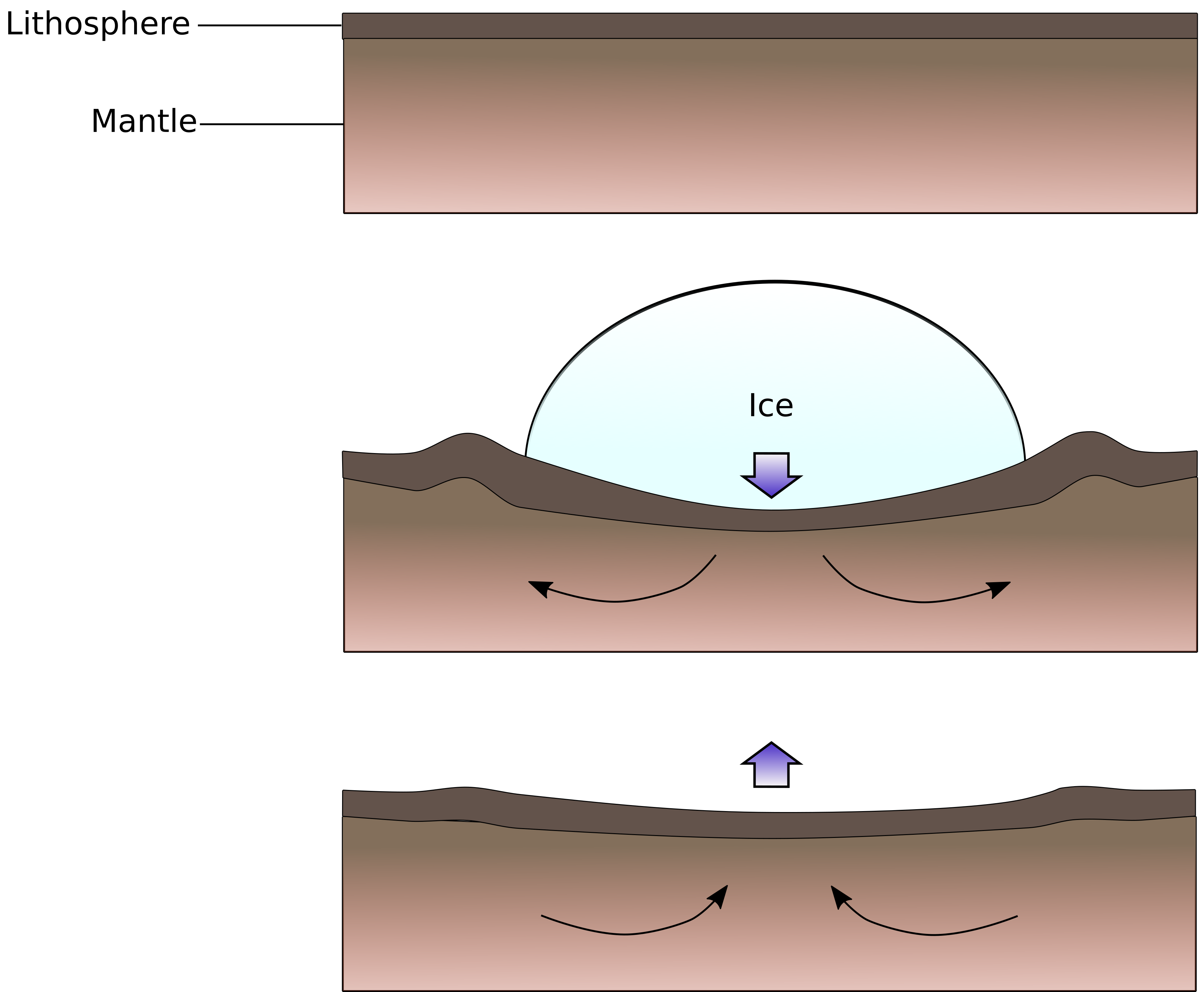
Changing ice volume results in changes to the Earth's surface through Glacial Isostatic Adjustment.
Glacial Isostatic Adjustment (GIA) is the change in elevation of the Earth's surface as a result of changing surface loads as ice advances or retreats. The Earth's lithosphere and mantle adjust to changes in surface loading: a growing ice sheet provides an increased surface load, and the Earth surface will subside. Once the ice melts, the Earth surface adjusts to the lessening of the load and uplift (post-glacial rebound) occurs. This includes both elastic changes in the lithosphere, and viscous changes in the mantle. Changes in land surface elevation due to post-glacial rebound can be dramatic, reaching values up to hundreds of metres, and rebound resulting from the melting of the Laurentide and Fennoscandian ice sheets is still ongoing.
With this in mind, we ask: what about the impact of changing lake and groundwater storage on GIA? By incorporating these changes into a GIA model, we can determine how significant their impact is. Preliminary work indicates that local sea level is affected by several metres when taking the impact of lakes and groundwater on GIA into account.
With this in mind, we ask: what about the impact of changing lake and groundwater storage on GIA? By incorporating these changes into a GIA model, we can determine how significant their impact is. Preliminary work indicates that local sea level is affected by several metres when taking the impact of lakes and groundwater on GIA into account.